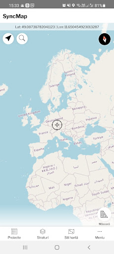
Features SyncMap
Mobile GIS application for offline fieldwork with geodata.
It provides data collection, viewing, and updating.
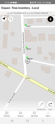
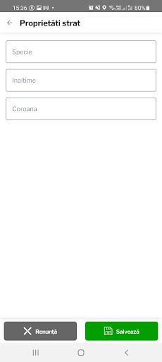
All its features are available above a wide selection of online, offline, and WMS maps.Fieldwork• offline collecting and updating of field data• saving points with current or arbitrary position• creating lines and polygons by motion recording• settings of attributes• photos as attachments• plant identification via PlantID• collecting location data for polygon / line recording or guidance on a target, even when the app is running in the backgroundImport / Export• importing and editing SHP files• exporting data to SHP or CSV files• exporting whole projects• export to FTPMaps• wide range of maps both for online use and for download• support of WMS sources• support of offline maps in MBTilesTools and features• measuring distances and areas• style editing and text labels• organizing data into layers and projectsPerfect to use in a wide range of industries:• collection of environmental data (ecological scanning, tree surveys ...)• forestry management and planning,• agriculture and soil management• gas and energy distribution• planning and construction of wind farms• exploration of mining fields and location of wells• survey and management of urban facilities• road constructions and maintenance
Camera Features
Advanced camera features with editing capabilities.
Food & Dining
Discover recipes and order food from your favorite restaurants.
Lifestyle
Enhance your lifestyle with personalized tips and features.
See the SyncMap in Action
Get the App Today
Available for Android 8.0 and above